
Coastal Radar
Sensor by

Collect time:
2024-11-19 14:05:24
Collect 1 of 15
Radar Return

Time Average
Radar Return
Time Average
Radar Return
Time Average
Radar Return
Time Average

Radar Return
Time Average
Radar Return
Time Average
Radar Return
Time Average
Radar Return
Time Average
Radar Return
Time Average
Radar Return
Time Average

Radar Return
Time Average
Radar Return
Time Average
Radar Return
Time Average
Radar Return
Time Average
Radar Return
Time Average
Jump to date:
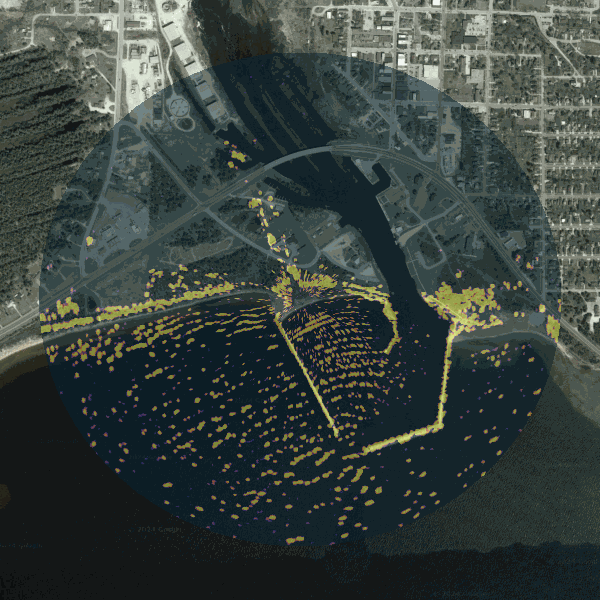
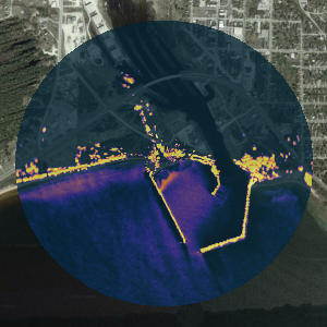
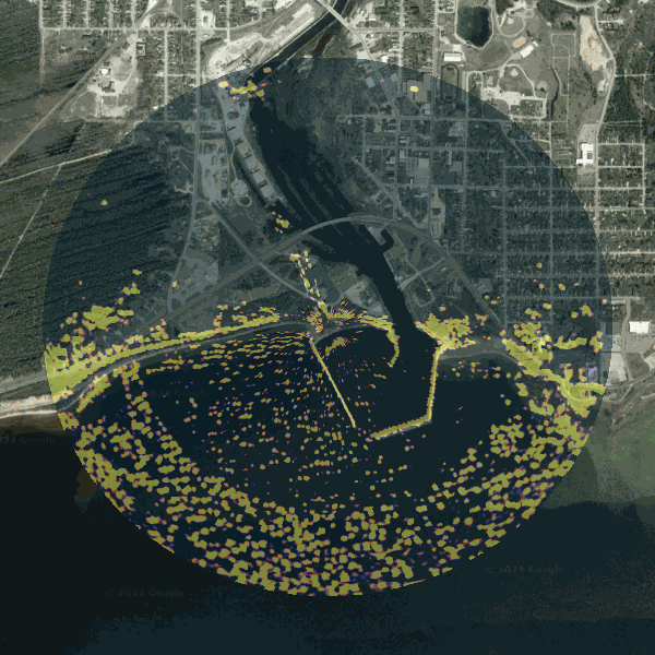
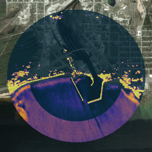
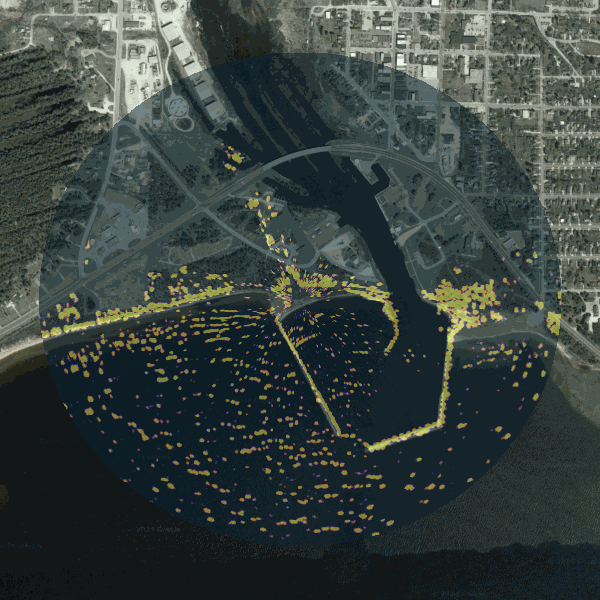
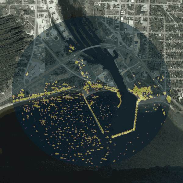
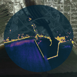
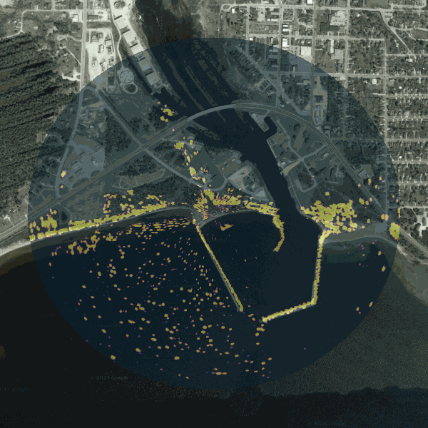
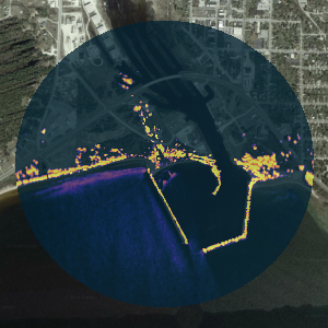
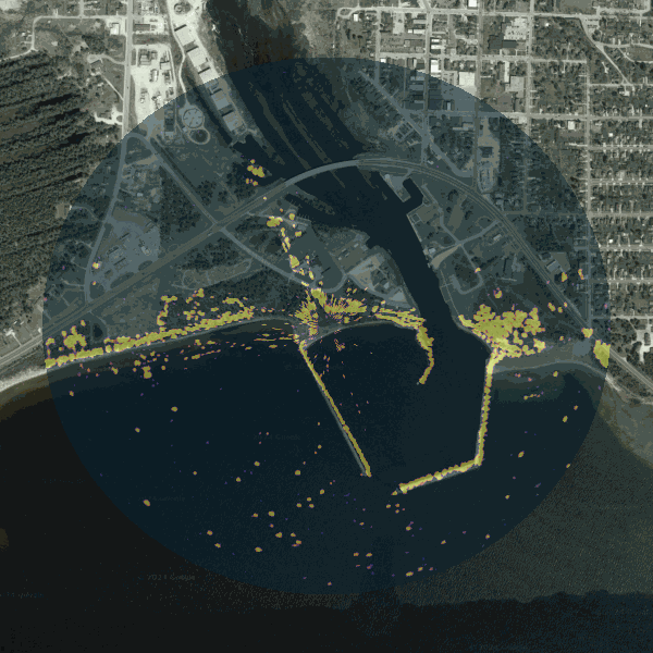
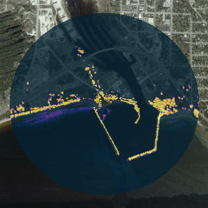
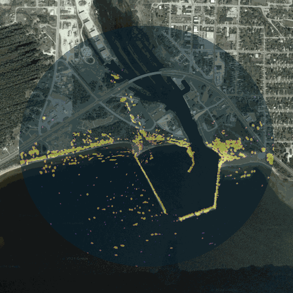
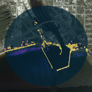
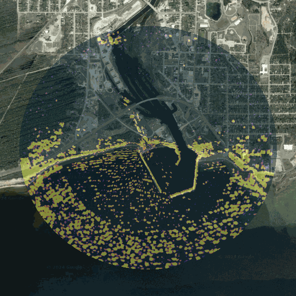
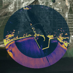
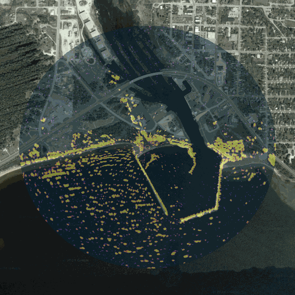
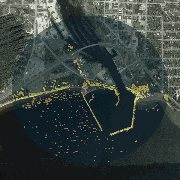
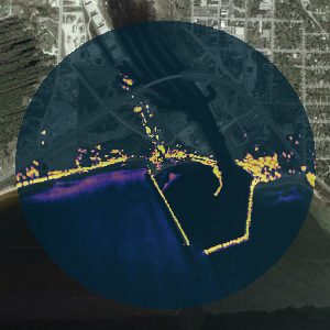
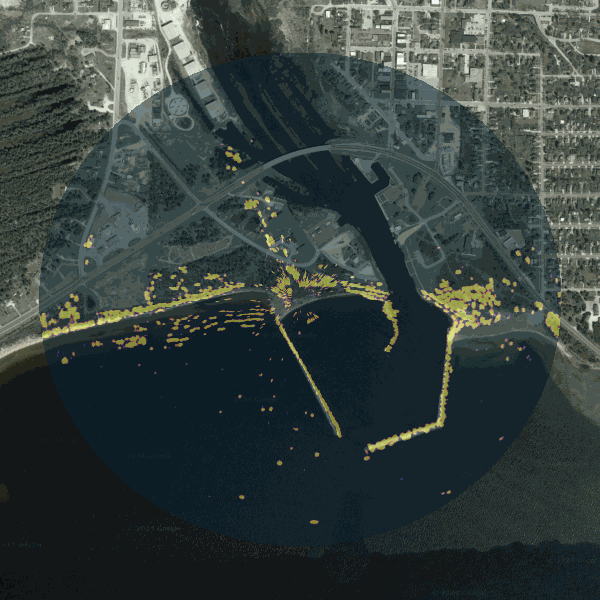
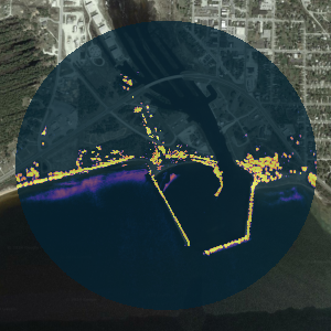
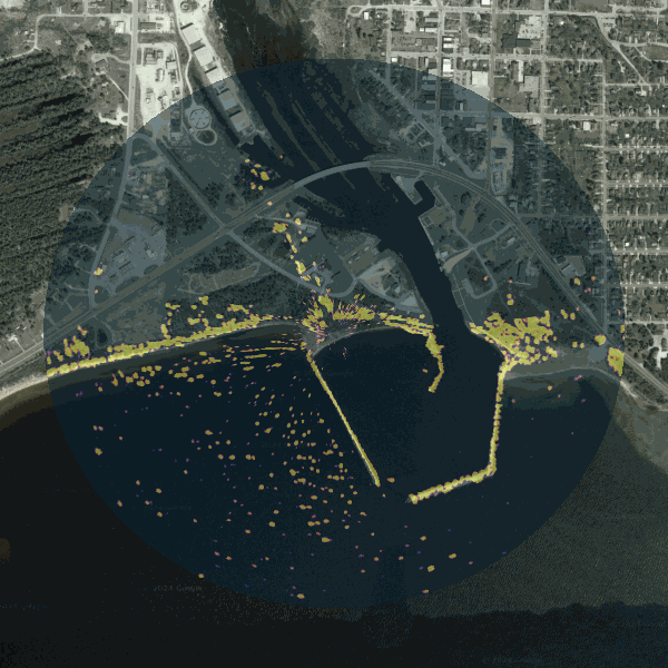
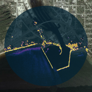
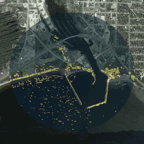
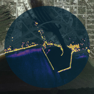
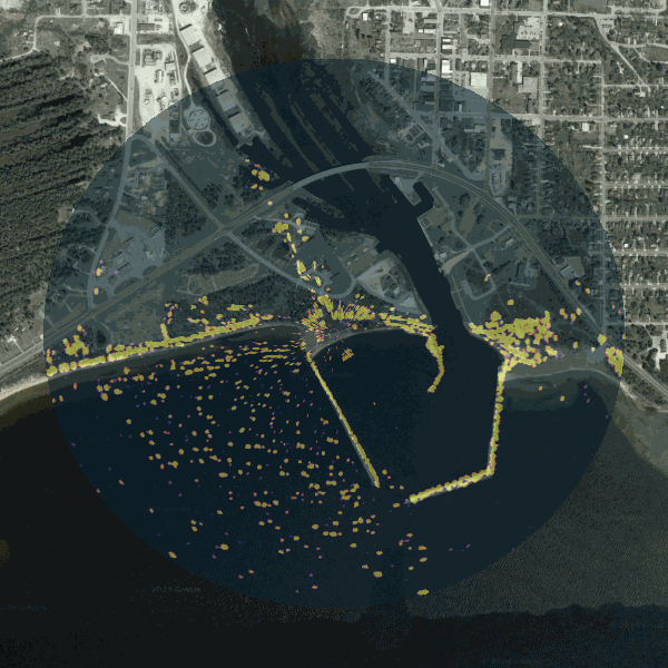
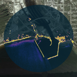
X‑Band coastal radar images surface waves by exploiting Bragg scattering from short gravity‑capillary
waves. The left panel shows an instantaneous radar return (GIF). Aggregating returns over time (right
panel) reveals persistent wave transformation and likely breaking patterns along bars, shoals, and
the surf zone.
Public Sensors Map
Loading nearby sensors…